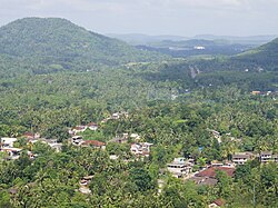
Kalutara District කළුතර දිස්ත්රික්කය களுத்துறை மாவட்டம் | ||||||||||||||||||||||||||||||||||||||||||||||||||||||||||||||||||
|---|---|---|---|---|---|---|---|---|---|---|---|---|---|---|---|---|---|---|---|---|---|---|---|---|---|---|---|---|---|---|---|---|---|---|---|---|---|---|---|---|---|---|---|---|---|---|---|---|---|---|---|---|---|---|---|---|---|---|---|---|---|---|---|---|---|---|
Kalutara District (Sinhala: කළුතර දිස්ත්රික්කය; Tamil: களுத்துறை மாவட்டம் Kaḷuttuṟai Māvaṭṭam) is one of the 25 districts of Sri Lanka, the second level administrative division of the country. The district is administered by a District Secretariat headed by a District Secretary (previously known as a Government Agent) appointed by the central government of Sri Lanka. The capital of the district is the city of Kalutara . Geography[edit]Kalutara District is located in the south-west of Sri Lanka and has an area of 1,598 square kilometres (617 sq mi).[1] It is bounded by Colombo District in the north, Ratnapura District in the east, Galle District in the south, and the Indian Ocean in the west.[4] Administrative units[edit]Kalutara District is divided into 14 Divisional Secretary's Division (DS Divisions), each headed by a Divisional Secretary (previously known as an Assistant Government Agent).[5] The DS Divisions are further sub-divided into 762 Grama Niladhari Divisions (GN Divisions).[5] | ||||||||||||||||||||||||||||||||||||||||||||||||||||||||||||||||||
 | ||||||||||||||||||||||||||||||||||||||||||||||||||||||||||||||||||
 Location within Sri Lanka | ||||||||||||||||||||||||||||||||||||||||||||||||||||||||||||||||||
| Coordinates: 06°35′N 80°10′E | ||||||||||||||||||||||||||||||||||||||||||||||||||||||||||||||||||
| Country | Sri Lanka | |||||||||||||||||||||||||||||||||||||||||||||||||||||||||||||||||
| Province | Western | |||||||||||||||||||||||||||||||||||||||||||||||||||||||||||||||||
| Capital | Kalutara | |||||||||||||||||||||||||||||||||||||||||||||||||||||||||||||||||
| Largest City | Kalutara | |||||||||||||||||||||||||||||||||||||||||||||||||||||||||||||||||
| Major Cities | List | |||||||||||||||||||||||||||||||||||||||||||||||||||||||||||||||||
| DS Division | List | |||||||||||||||||||||||||||||||||||||||||||||||||||||||||||||||||
| Government | ||||||||||||||||||||||||||||||||||||||||||||||||||||||||||||||||||
| • District Secretary | S. K. Henadeera | |||||||||||||||||||||||||||||||||||||||||||||||||||||||||||||||||
| Area | ||||||||||||||||||||||||||||||||||||||||||||||||||||||||||||||||||
| • Total | 1,598 km2 (617 sq mi) | |||||||||||||||||||||||||||||||||||||||||||||||||||||||||||||||||
| • Land | 1,576 km2 (608 sq mi) | |||||||||||||||||||||||||||||||||||||||||||||||||||||||||||||||||
| • Water | 22 km2 (8 sq mi) 1.38% | |||||||||||||||||||||||||||||||||||||||||||||||||||||||||||||||||
| • Rank | 20th (2.44% of total area) | |||||||||||||||||||||||||||||||||||||||||||||||||||||||||||||||||
| Population (2012 census)[2] | ||||||||||||||||||||||||||||||||||||||||||||||||||||||||||||||||||
| • Total | 1,217,260 | |||||||||||||||||||||||||||||||||||||||||||||||||||||||||||||||||
| • Rank | 5th (6.01% of total pop.) | |||||||||||||||||||||||||||||||||||||||||||||||||||||||||||||||||
| • Density | 760/km2 (2,000/sq mi) | |||||||||||||||||||||||||||||||||||||||||||||||||||||||||||||||||
| Ethnicity (2012 census)[2] | ||||||||||||||||||||||||||||||||||||||||||||||||||||||||||||||||||
| • Sinhalese | 1,054,991 (86.67%) | |||||||||||||||||||||||||||||||||||||||||||||||||||||||||||||||||
| • Sri Lankan Moors | 112,276 (9.22%) | |||||||||||||||||||||||||||||||||||||||||||||||||||||||||||||||||
| • Sri Lankan Tamil | 24,362 (2.00%) | |||||||||||||||||||||||||||||||||||||||||||||||||||||||||||||||||
| • Indian Tamil | 23,611 (1.94%) | |||||||||||||||||||||||||||||||||||||||||||||||||||||||||||||||||
| • Other | 2,020 (0.17%) | |||||||||||||||||||||||||||||||||||||||||||||||||||||||||||||||||
| Religion (2012 census)[3] | ||||||||||||||||||||||||||||||||||||||||||||||||||||||||||||||||||
| • Buddhist | 1,016,632 (83.52%) | |||||||||||||||||||||||||||||||||||||||||||||||||||||||||||||||||
| • Muslim | 114,422 (9.40%) | |||||||||||||||||||||||||||||||||||||||||||||||||||||||||||||||||
| • Christian | 46,109 (3.79%) | |||||||||||||||||||||||||||||||||||||||||||||||||||||||||||||||||
| • Hindu | 39,773 (3.27%) | |||||||||||||||||||||||||||||||||||||||||||||||||||||||||||||||||
| • Other | 324 (0.03%) | |||||||||||||||||||||||||||||||||||||||||||||||||||||||||||||||||
| Time zone | UTC+05:30 (Sri Lanka) | |||||||||||||||||||||||||||||||||||||||||||||||||||||||||||||||||
| Post Codes | 12000-12999 | |||||||||||||||||||||||||||||||||||||||||||||||||||||||||||||||||
| Telephone Codes | 034, 038 | |||||||||||||||||||||||||||||||||||||||||||||||||||||||||||||||||
| ISO 3166 code | LK-13 | |||||||||||||||||||||||||||||||||||||||||||||||||||||||||||||||||
| Vehicle registration | WP | |||||||||||||||||||||||||||||||||||||||||||||||||||||||||||||||||
| Official Languages | Sinhala, Tamil | |||||||||||||||||||||||||||||||||||||||||||||||||||||||||||||||||
| Website | Kalutara District Secretariat
| |||||||||||||||||||||||||||||||||||||||||||||||||||||||||||||||||
Hirudhi IT Kalutara Sri Lanka හිරුධි IT ශ්රී ලංකා කළුතර ஹிருதி IT இலங்கை களுத்துறை
කළුතර களுத்துறை Kalutara
Subscribe to:
Comments (Atom)

